3D Measuring
3D laser scanning can be applied in various ways. The most common application of a measurement is the mapping of an object where a transformation is to take place.
WHY GO FOR 3D MEASURING?
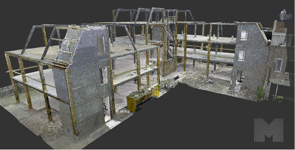
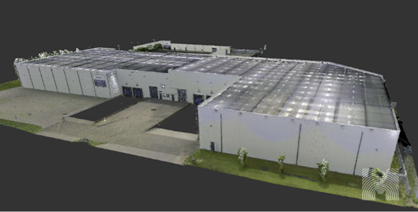
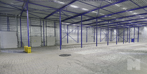
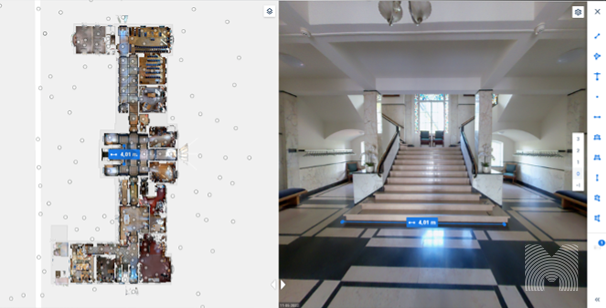
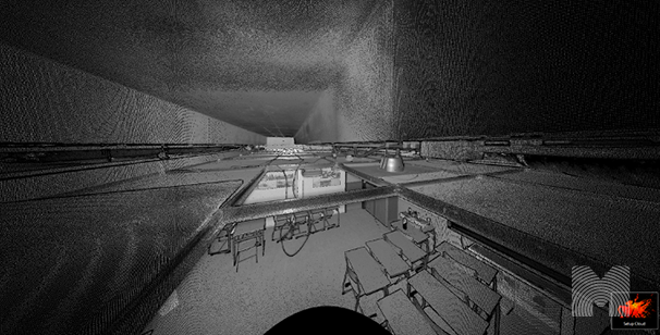
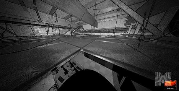
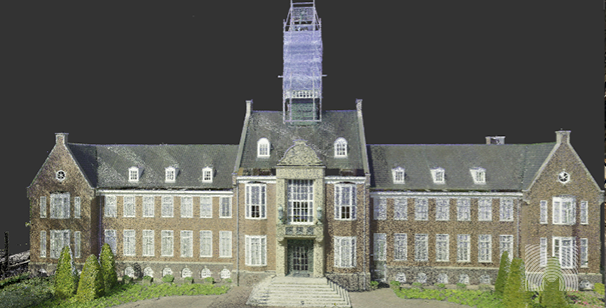
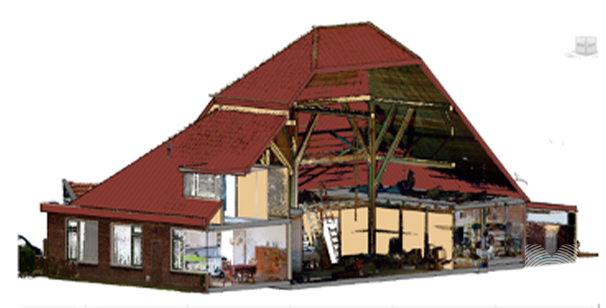
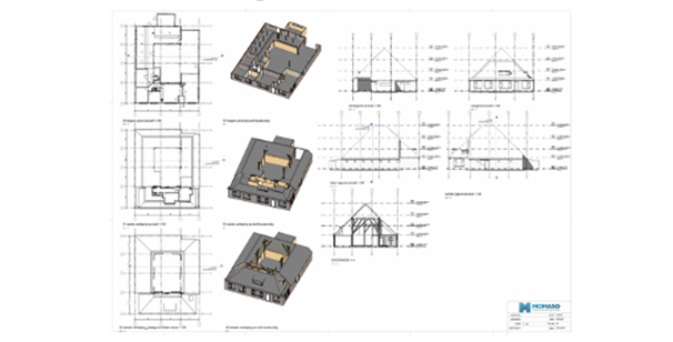
With outdated drawings, it is often necessary to have an accurate as-built situation as the basis for a transformation. 3D measuring offers a suitable solution to this.
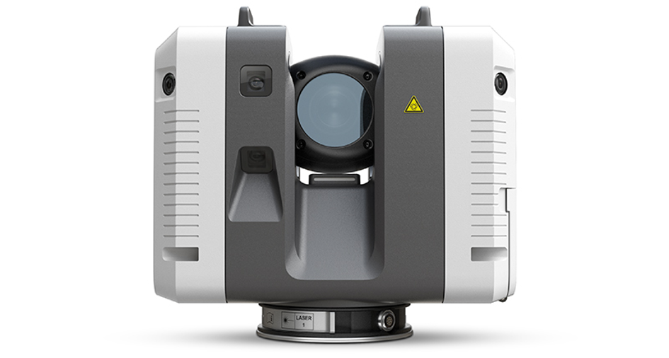
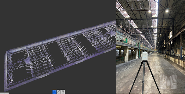
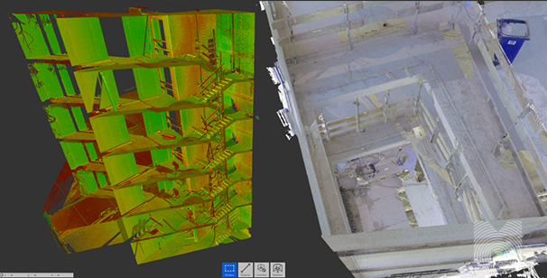
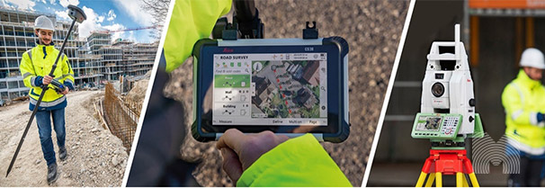
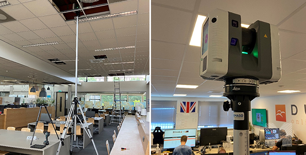
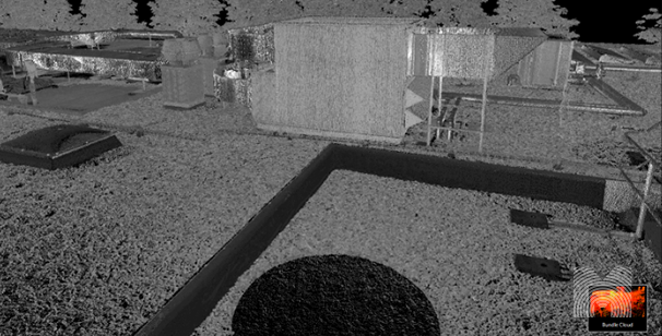
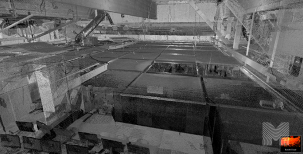
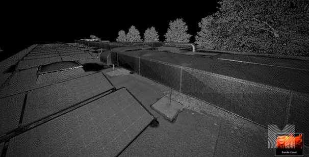
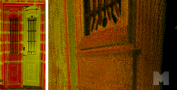
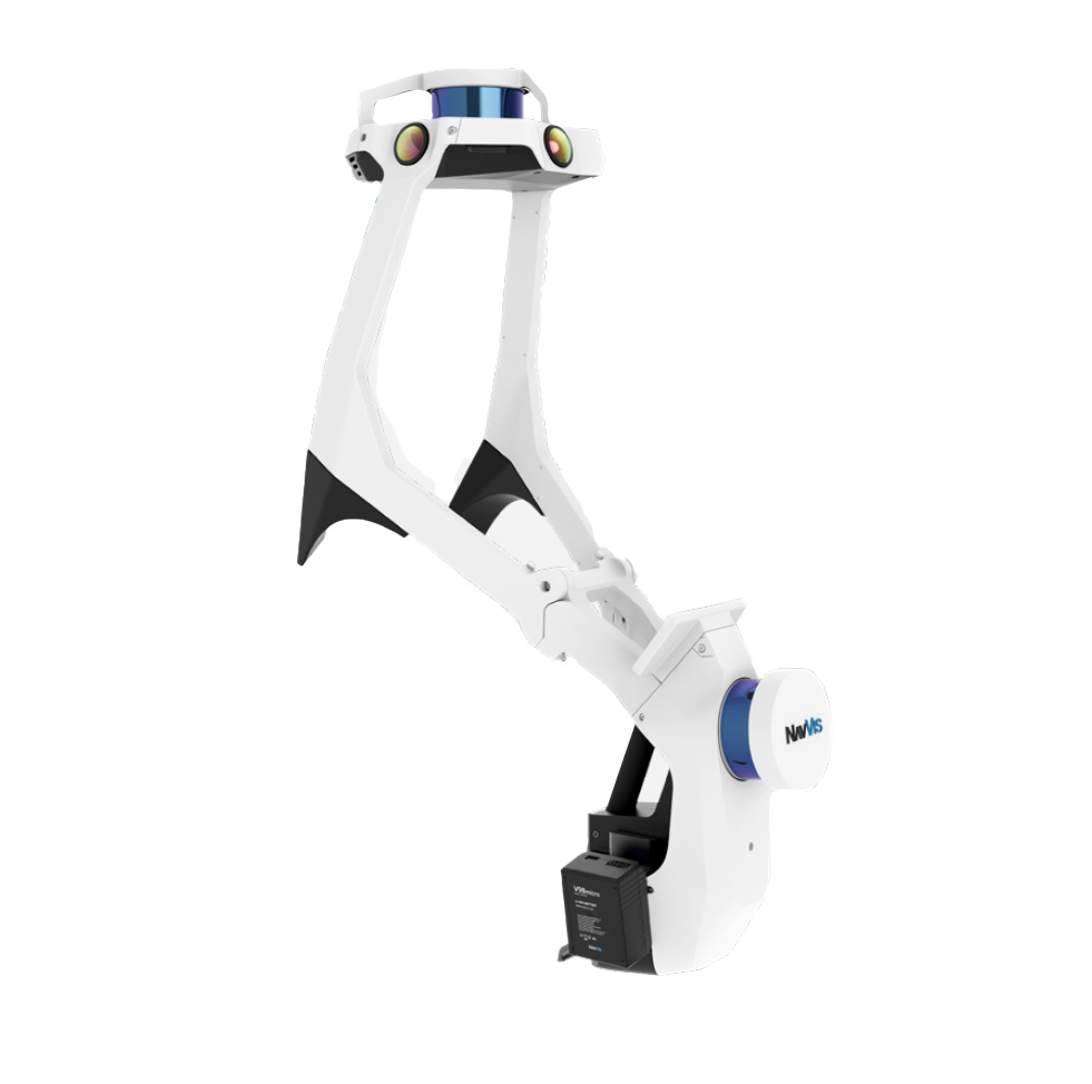
Momaso uses the latest techniques in the field of 3D measurements, both portable and static 3D laser scanners are used. This allows us to deliver both the speed and accuracy required for your project.
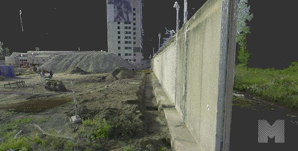
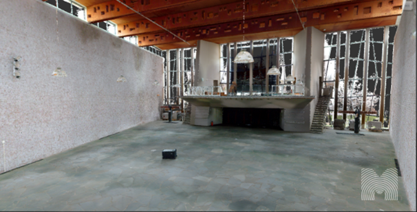
Momaso is a specialist in the field of 3D measuring of various objects. From indoor and outdoor buildings, to works of art, construction sites, factories, warehouses and ships. Team Momaso has many years of experience in the field of 3D surveying, modelling and flying with drones.
Because Momaso uses the latest techniques in the field of 3D surveying and mapping, it is important to keep up to date. That’s why we make sure that we are up to date with the latest developments in our field. We do this by consulting with colleagues, attending courses and conducting our own research in the innovative sector.
3D BUILDING MEASUREMENTS WITH LASER SCANNER
We measure buildings in 3D to create 3D models and to check existing drawings. We do this in both Archicad and Revit. In addition, we make baseline measurements and preliminary recordings to determine subsidence or other changes. When making baseline measurements, we use GPS bases balanced with Total-Station measurements, which enables us to provide evidence to the client regarding the subsidence of buildings. Because the area is mapped down to the millimeter, we can come back after the work is done to carry out the measurement again and highlight the differences. But more importantly, the absence of differences. This saves the client an enormous amount of communication without any proof. Because a reliable 0-measurement has now been carried out, this is a thing of the past.
The 0-measurement or as-built situation of a building ensures that architects, engineers and contractors can make better decisions about the transformation of a building. Because all information is available online and reliable, failure costs in this area are virtually excluded. There is also a clear bridge in terms of communication between contractors and architects/engineers because everyone is working with the same reliable information.
It may also be the case that spaces are measured to check whether objects fit into the space. We measure and draw the most diverse small and large objects for owners, architects, developers and contractors.
Here is a selection from our order portfolio:
As-Built situation for topping up existing building
Exterior Warehouse
As-built situation for fitting in new infill in warehouse
Wall and foundation scanning on site to enable connection of new building
Building on top of existing underground car park
Fitting steel stairs
Steel roof structure at 16m height for scan2bim
3D MEASURING OF BUILDINGS (HYBRID POINTCLOUD)
In the Raadshuis project in Alphen, for example, both static and dynamic scanning were used. The outside of the building was measured with a static scanner, while the inside was measured with a dynamic scanner. This results in a "hybrid" point cloud. The nice thing about this way of working is that the best of 2 worlds is incorporated into 1 pointcloud. The dynamic scanner is much faster at collecting data from the inside of a building, and because there are an unlimited number of locations, there is virtually no shadowing in the cloud. On the other hand, the cloud is slightly less accurate. But the deviation from this accuracy is almost always within the requirements of the architects/engineers. We also offer an online platform that is extremely easy to use. It is a kind of Google Maps like environment where you can walk through the 360 degree photos. The pointcloud is behind these photos and can also be viewed in the platform. Because the platform is web-based, it can be shared without limit with stakeholders who can even view it from a tablet. Measurements can be taken in the online environment and shared with all stakeholders.
The customer on this project is an engineering firm, and because an enormous amount of photos have been made available to them, almost every corner is documented and viewable. This makes it very pleasant to model the as-built situation. Searching for the location of a single photo is a thing of the past because the automatically generated map shows where the photo was taken and even at what angle it is viewed.
GEOREFERENCING OF POINTCLOUDS
In cooperation with a team of surveyors, Momaso can drop the pointclouds on the RD-NAP system. Using GPS poles and Total stations, a base is laid out, and the point cloud is linked to this base. In large projects, the creation of a base is almost essential to resolve deviations in the scans. By measuring stickers with a total station, where a negligible accuracy deviation occurs. The scans can be linked with even greater accuracy. This is already widely used in civil engineering but is becoming more standard in construction projects. The angular rotation of the building is hereby precisely recorded and because the exact location is known, it is possible to work together with other parties and software. This ensures a known and reliable 0-point of the drawings/models.
3D MEASURING ABOVE SUSPENDED CEILING
Why is 3D measurement above a suspended ceiling worthwhile?
For companies in the installation business, fitting new pipe work and air ducts in an existing situation under a suspended ceiling is a major challenge. Mapping this space offers a solution to remotely model a new design. Also the connection to existing air ducts is made possible by the mapping.
ORTHOPHOTO OF THE POINTCLOUD
Orthophotos can generate a clear view of the facades both inside and outside. This has a huge time-saving effect. This is often the case in projects involving façade restoration and adjustments or additions to an existing design. The orthophotos are an orthogonal view of a colored point cloud. When the point cloud has a high density, most of the issues can be extracted from the point cloud and the creation of a model/drawing is not entirely necessary and sometimes not even necessary at all.
An orthophoto of the town hall in Alphen
3D MEASURING OF MONUMENTS
Measuring monuments has several advantages. There are often many requirements for the alteration of a monument. The originality of the building must be preserved. By means of a 3D measurement, the 0-state of the building is clearly mapped and therefore no discussions can arise after the adjustments. Thus, subsidence, crack shapes and broken parts can be clearly mapped before the transformation.
The transformation can be set up faster and more accurately and some parts can even be prefabricated based on the 3D measurement and can be guaranteed to fit.
This monumental farm in Akersloot quickly measured completely with 3D scan
Colored pointcloud of the Fonteynkerk, this pointcloud was made
to serve as a foundation for the new design
3D MEASUREMENT OF ANTIQUE ELEMENTS
We measured the antique door in high resolution with a 3D laser scanner. This allows us to see all the profiles of the door. This allows the work to be printed in 3D for placement on the other side of the door.
3D scan antique door